Author Archives: Aron & Linda

To the End of the World and Back

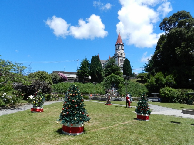
As I write this from back home in California, it almost feels like it was all a dream. That only a few weeks ago we were adventuring through Patagonia until we went as far as we could go- to the end of the world.

DSCN6939 (640x480)

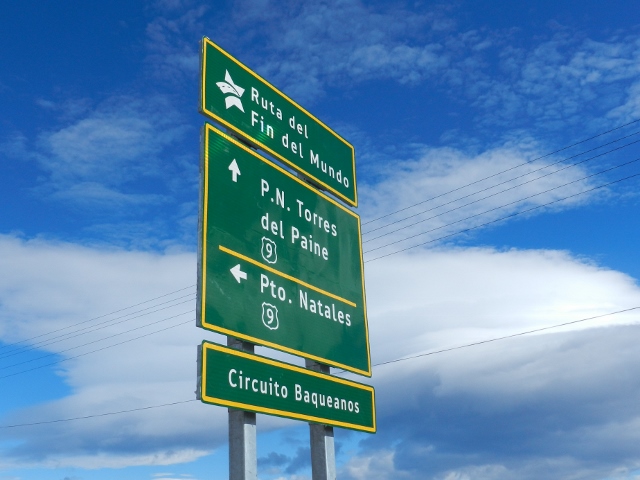
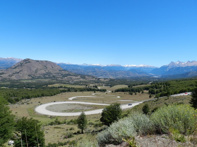
The end of the world route

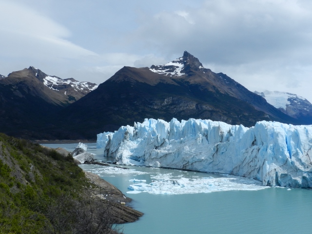
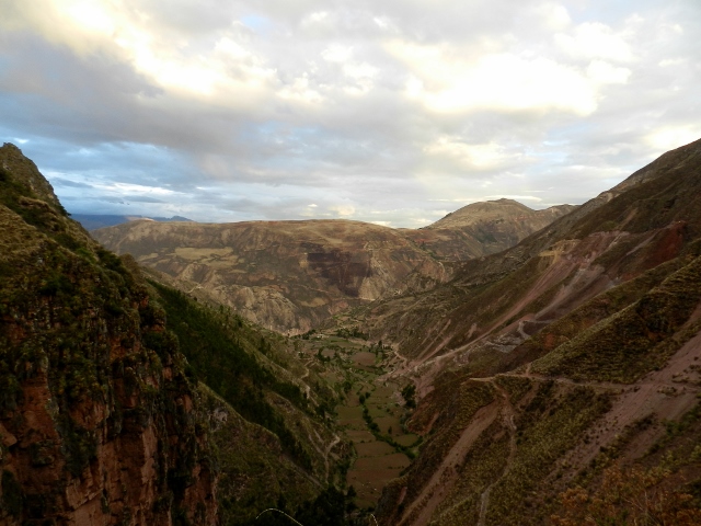
We ventured back into Chile to visit Torres del Paine National Park, a hikers paradise that draws travelers from all over the world. The park encompasses incredible mountains, glaciers, rivers, and lakes and is home to condors, guanacos, puma, and deer.

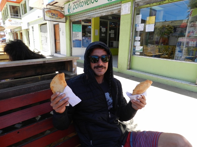
Torres del Paine is home to two world famous hiking routes, the W and the Full Circuit which take about 5 and 9 days to complete, respectively. With a limited amount of time and hardly any food, we opted to do two thirds of the W with our friends George and Teresa (Road Adventure). Chile is extremely strict with the transport of food into their country so we crossed the border with hardly anything, drove straight to the national park, and hoped for some sort of a store. We realized we blew it when all we could find was a little kiosk that sold cookies and chips for three times the normal price- so we got creative. I baked a bunch of bread rolls on our camp stove and we shelled out some money for cheese, salami, trail mix, and chocolate- you know, the hiking essentials.

DSCN6973 (640x480)

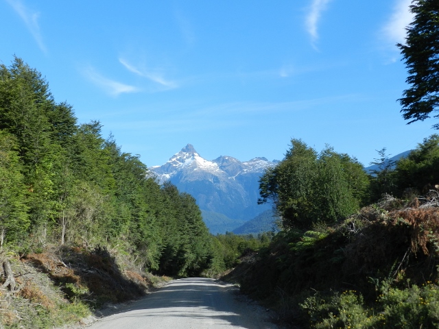
Heading into the park
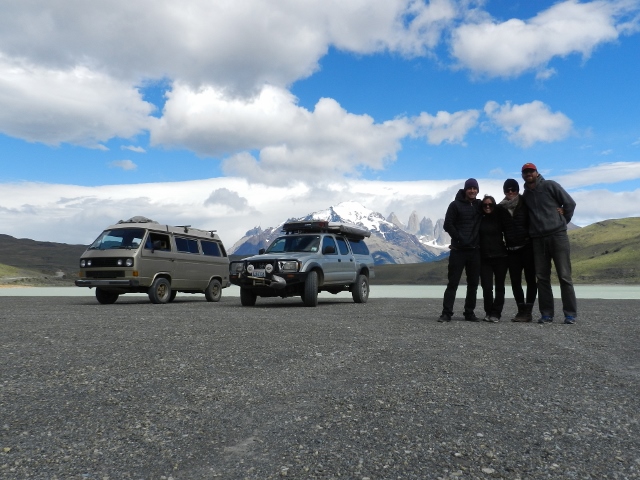
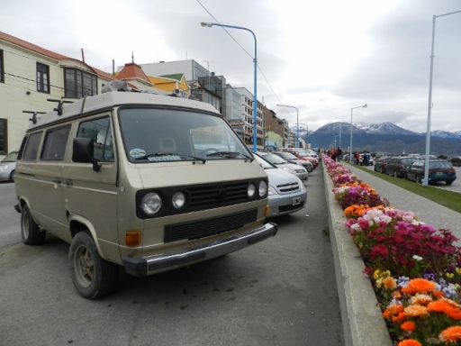
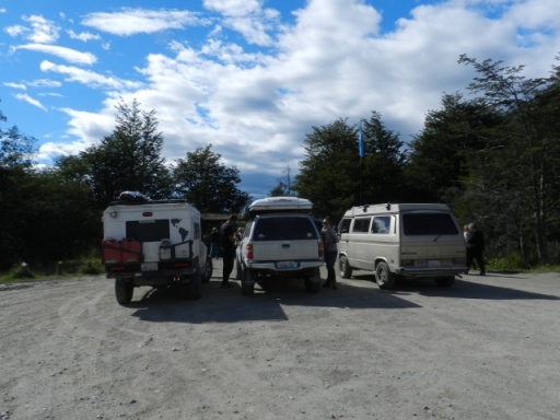
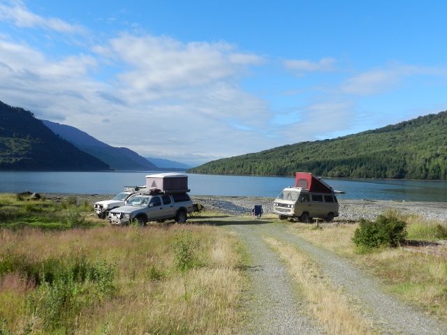
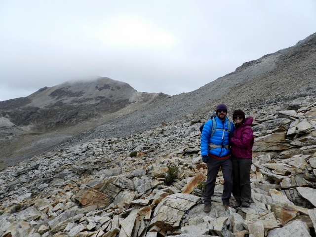
DSCN6984 (640x480)

Caravan photo op

DSCN6966 (640x482)

Guanacos grazing on the side of the road

DSCN7004 (640x480)

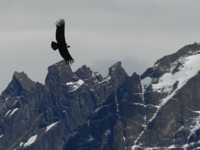
We were lucky to watch this enormous condor soar around right above us

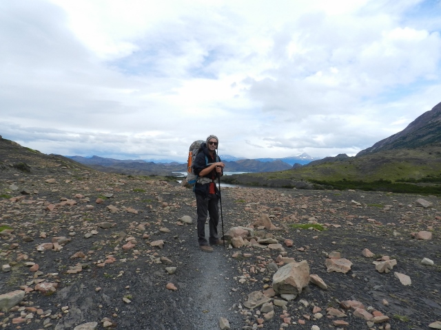
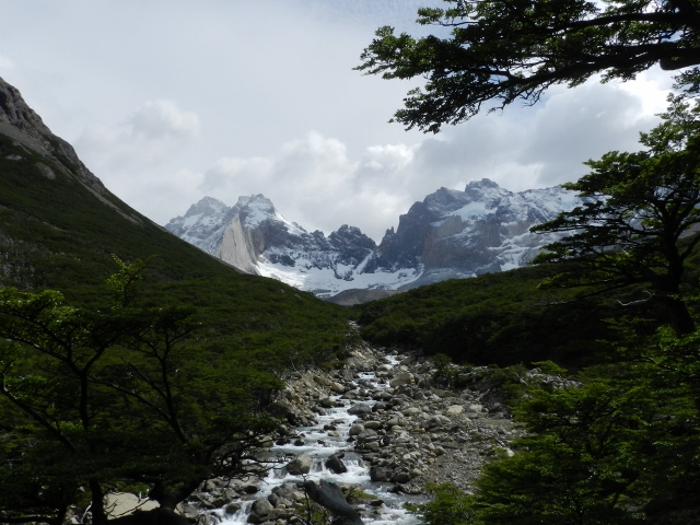
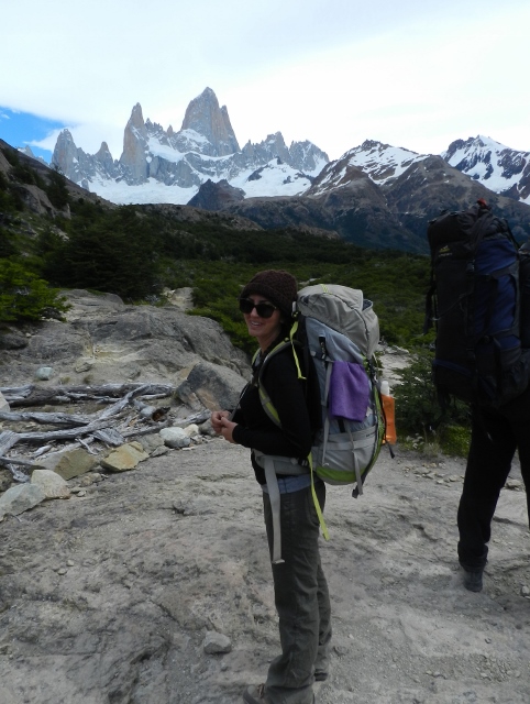
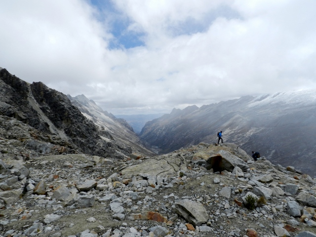
The first leg of the W took us through sub polar forest before we scurried up a section of rocky, wind exposed trail to the stone towers of the Torres del Paine, probably the most visited and photographed feature in the park.

DSCN7028 (640x480)

DSCN7053 (640x480)

While the photo above looks nice and peaceful, once in a while an enormous gust of icy wind would blow by, nearly knocking us over. The photo below will give you an idea of what I mean:

DSCN7058 (480x640)

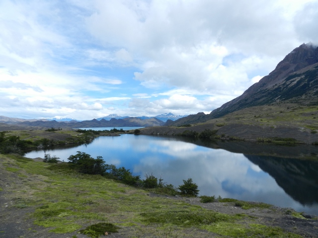
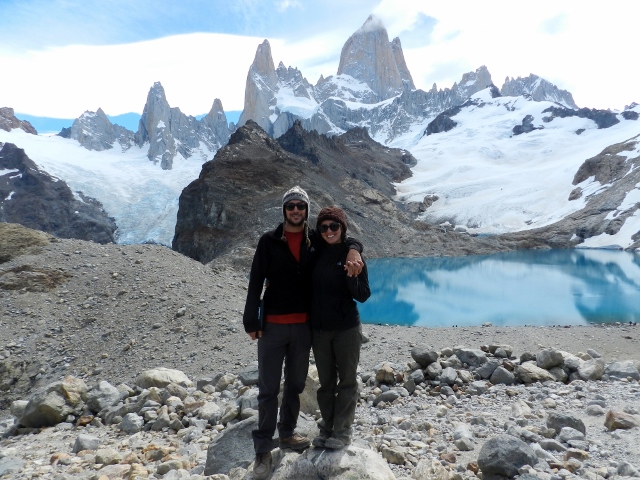
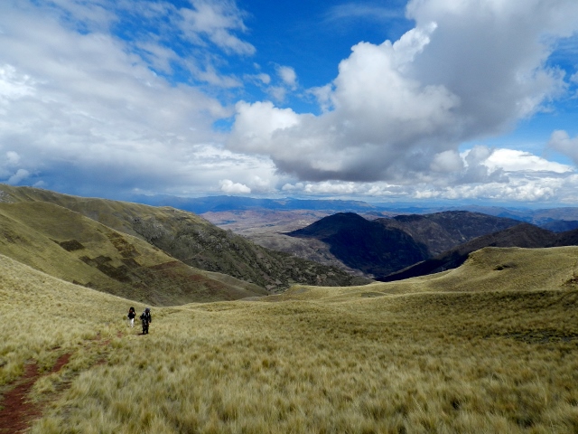
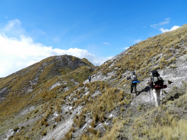
The second leg of the hike, the middle section of the W, took us along a beautiful lake and into the spectacular Valle del Frances (French Valley).
DSCN7093 (640x480)

DSCN7103 (640x480)

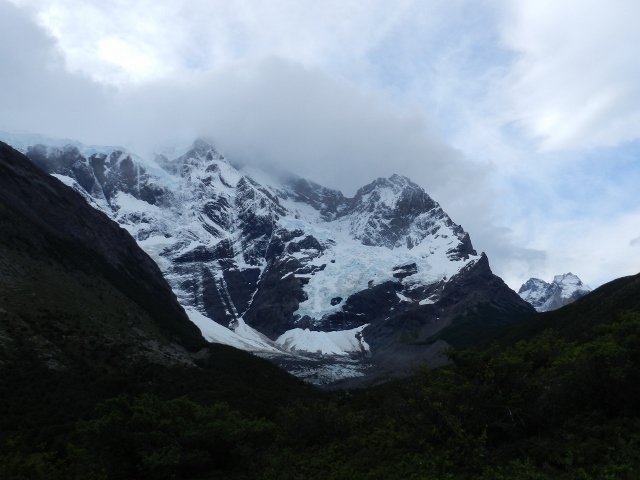
On our way into the valley we heard a loud rumbling that we thought was thunder. We looked up at the mountain on our left and saw an enormous wave of snow tumbling down- it was an avalanche! We stood there in awe and tried to gauge whether we should run while imagining the campground we were heading to inundated with snow. When we arrived at the campground we found it in perfect order and learned that avalanches happen in Valle del Frances all the time. Well, that was quite a surprise! Throughout our hike in the valley we saw smaller avalanches and heard lots of thundering but nothing like the doomsday we witnessed on our way in.

DSCN7208 (640x480)

Site of the avalanche. You can see snow piled up at the bottom of the mountain.

The Valley was absolutely gorgeous. One of my favorite features was the mountain in this photo below called Cuernos del Paine, cuernos meaning horns, but I like to call it marble cake mountain. Doesn’t it look like a cake? Maybe I was just hungry and delirious.

DSCN7209 (640x480)

Cuernos del Paine

DSCN7250 (640x480)

Hiking up up up into the Valle del Frances

DSCN7307 (640x480)

Valle del Frances

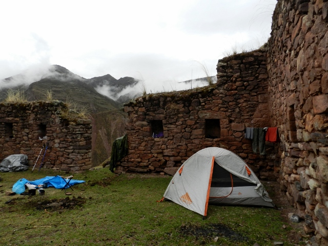
All along the W circuit you can find nice, cozy refugios, or mountain refuges, that offer meals and lodging but with a hefty price tag. They are mainly utilized by hikers that don’t have their own gear or by tourists that are taken in on horseback. One of the refuges we hiked past even had hot tubs! Yes, that was a hard one to pass by…

DSCN7065 (640x480)

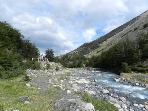
A lovely refuge in Valle del Frances

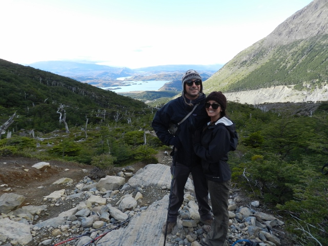
We had heard about Torres del Paine for months during our travels in Chile and Argentina but never imagined it to be this beautiful. We were blown away by how incredible it was and hope to return one day to complete the whole circuit of the park.

DSCN7334 (640x480)

One last look at the spirals of Cuernos del Paine, my favorite mountain.

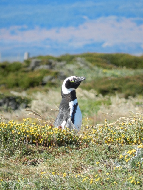
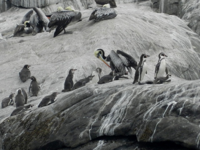
We headed south, stocked up on food and internet in Puerto Natales, and made our way to a Magellanic penguin colony. The comical little penguins hang out on the coast of Chile about an hour north of Punta Arenas from September-March to nest and lay eggs. We watched them pop out from their burrows in the sand dunes and waddle around among the shrubs and flowers. One diligently harvested individual pieces of grass and carried them into his burrow to make a cozy nest.

DSCN7527 (480x640)

Hey buddy

DSCN7467 (640x480)

A penguin debate

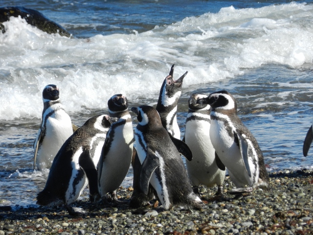
We heard there was also a newly discovered colony of king penguins nearby so we hopped on a ferry in Punta Arenas and crossed the Straight of Magellan in Chile’s Tierra del Fuego. This is the first colony of king penguins that has been found outside of Antarctica and was only discovered in 2011 on a remote stretch of cold, windy, Chilean coast.

DSCN7578 (640x480)

DSCN7582 (640x480)

DSCN7592 (640x480)

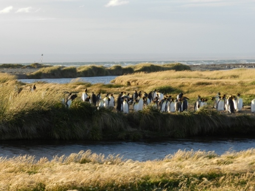
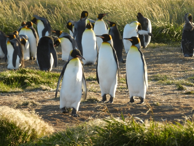
The king penguins are regal compared to the little goofy Magellanic penguins we had just visited, with a beautiful burst of yellow around their heads and necks. We watched them walk around in pairs and snuggle together for warmth. The groundskeeper let us camp on the property so we had an evening with the penguins to ourselves. It was absolutely incredible besides the icy blasting wind but that’s a small price to pay to hang out with penguins.

DSCN7576 (640x480)

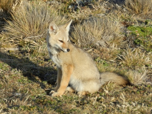
This adorable baby fox payed us a visit while we camped

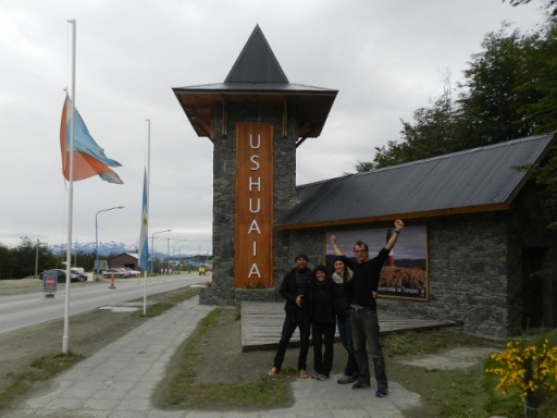
We woke up to a rainy morning, quickly said goodbye to the penguins, and headed out. Today we would cross into Argentina and finish the last southbound drive of our trip. With rain pattering on our windshield we drove until the landscape of dry, barren grassland changed into forests and craggy, snow covered mountains. Before we knew it we arrived in Ushuaia, the southernmost city in the world!

DSCN7660 (640x480)

DSCN7661 (640x480)

The good ol’ van at the end of the world. Thanks vany, we made it!

We decided not to partake in the $10,000 cruise to Antarctica (not that we had a choice) and instead camped at Pista del Andino (Andean Road), a popular overlanding campground, and celebrated with a proper Argentinian BBQ (meaning lots of meat) and wine.

DSCN7672 (640x480)

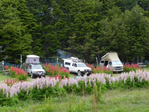
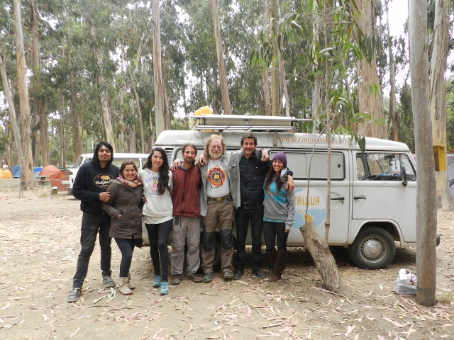
Camping with friends at the end of the world

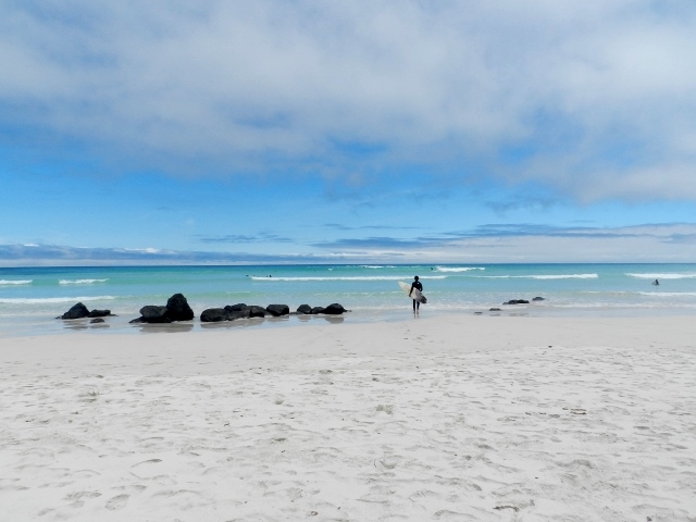
On another rainy morning we set out to visit Tierra del Fuego National Park. The rain was really coming down and we contemplated bailing out, but we pressed on and luckily the sun came out the moment we arrived. A lovely coastal hike took us through forests and along sandy, shell filled beaches. The end of the world sure is beautiful!

DSCN7729 (640x480)

DSCN7754 (640x480)

DSCN7767 (640x480)

DSCN7736 (640x480)

DSCN7841 (640x481)

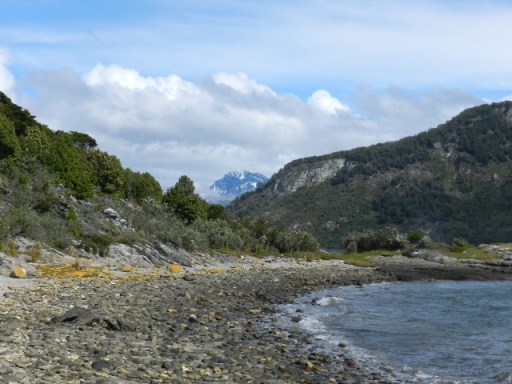
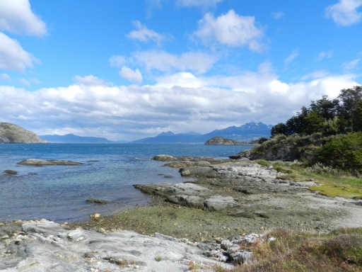
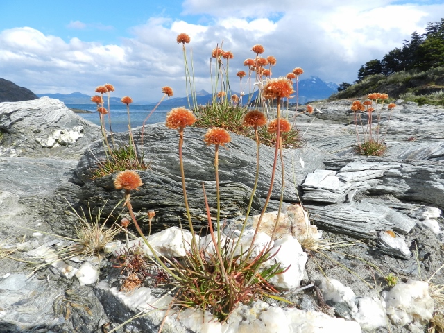
At the end of the road

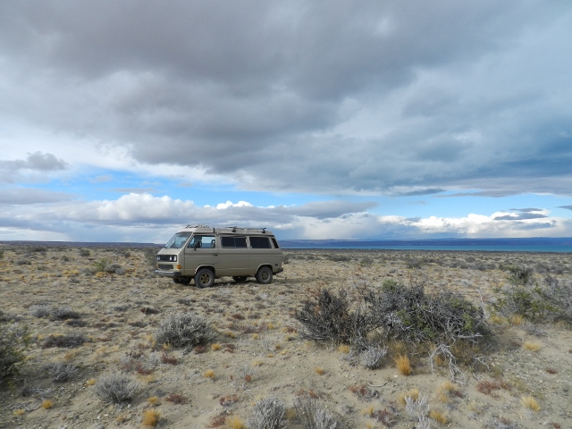
With the shipping date for the van approaching, we reluctantly left the beauty of Tierra del Fuego, turned around, and headed north for the first time. And so began the hellish one week drive up the east coast of Argentina to Buenos Aires. We had been told how dull and torturous this drive was going to be, and it really was as bad as everyone said. It took us six days of driving eight hours a day through flat brown grass as far as the eye could see. The highway only neared the coast for a few miles during the entire drive so we didn’t even have the ocean to distract us. The only thing that kept us entertained were the beautiful clouds that dotted the sky all the way to the distant horizon and listening to podcasts.
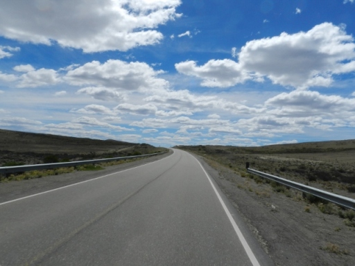
DSCN7877 (640x481)

Argentina’s Route 3

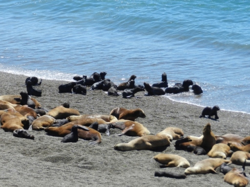
One worthwhile but lengthy stop along the drive is the Valdes Peninsula, famous for the documentary filmed there that shows orcas beaching themselves to snatch up baby sea lions from the shore. This only happens in February and March and being the middle of February, we decided we had to take our chances if there was a remote possibility that we might see this phenomenal spectacle. We drove out to the peninsula and camped on the beach before spending a day exploring the wildlife with our fingers crossed for some action.

DSCN7886 (640x480)

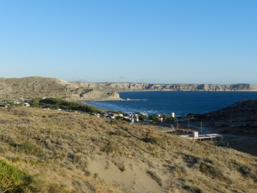
Punta Piramides, the only town on the Valdes Peninsula

DSCN7905 (640x480)

The peninsula is much larger than we expected and it took us four hours to drive around the whole thing. This on top of the eight hour drives we had been doing was rough, but the thought of killer whales snatching up baby sea lions kept us going. We visited another penguin colony, saw lots more guanacos and rheas, and then arrived at the beach where the action happens. We watched the adorable sea lion pups play along the shoreline and hoped with all our hearts that an orca would come snatch one up. Sad- yes, I know. Unfortunately for us, the orcas never showed up so we reluctantly got back in the car and hit the road again.

DSCN8009 (640x480)

Seal snatching orca beach

DSCN8020 (640x480)

Look at those tasty little morsels

More than a year of life on the road definitely took a toll on the van and it was starting to show. We practically limped it the final stretch. A day before we made it to Buenos Aires a coolant hose blew- reminiscent of our breakdown in Ecuador but luckily we were able to find a replacement relatively easily (it only took us six hours). Come on vany, just a little further!

DSCN8035 (640x480)

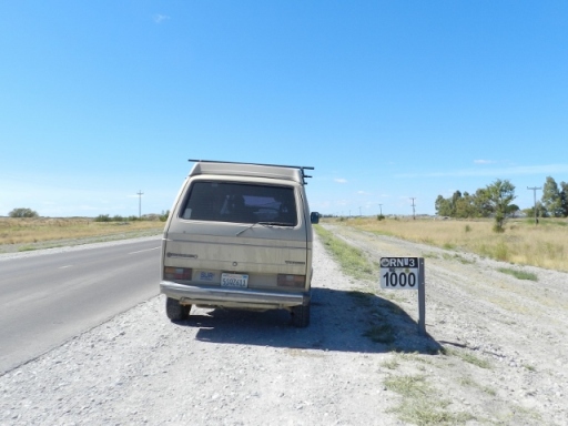
Only 1000 km left to go!

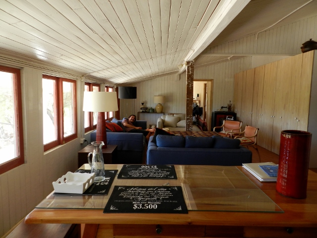
Never have we been so relieved to get out of the van and into an apartment when we finally arrived in Buenos Aires. We rented a sweet little place with Joe and Kylee (Patagonia or Bust) for a week in San Telmo, the oldest residential neighborhood in Buenos Aires. Our own bedroom, hot showers, a kitchen, and lots of bars and restaurants in walking distance made it the perfect base to explore the city.

DSCN8051 (640x480)

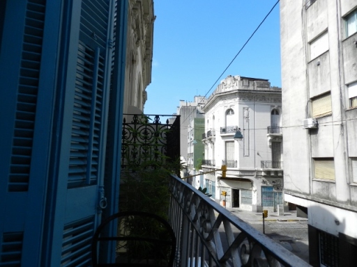
View from our balcony

DSCN8054 (640x481)

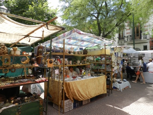
Saturday antique market in San Telmo

First things first, we had to move all our stuff out of the van, our home for the last year and more. We donated lots of our stuff to the guy who ran the paid parking lot across the street from our apartment- clothes, food, cleaning supplies, etc. He was so happy he let us park for free and even washed the van for us.

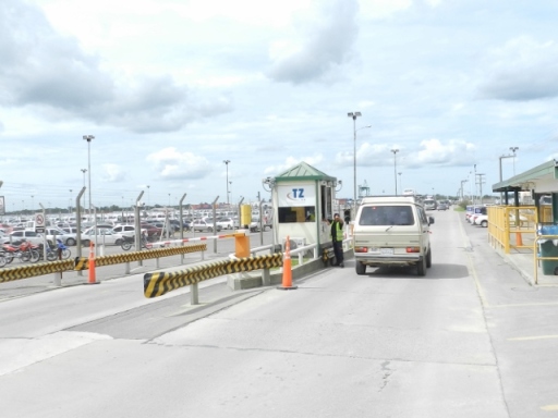
Then it was time to part with the van. We drove an hour north of Buenos Aires to the shipping port in Zarate, handed over our keys to a port employee, and waved goodbye to the van as it entered the unknown. We are just hoping that it actually ends up back in California!

DSCN8077 (640x480)

The van’s adventures continue as it sails through the Panama Canal!

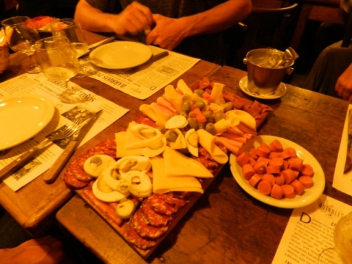
Free of the van and any further responsibilities, we set out to enjoy Buenos Aires. We strolled around the Saturday antiques market, cooked at the apartment, and went out for wine and charcuterie at a cool local bar called El Federal, a casual place with meats and cheeses hanging from the cieling. Buenos Aires has a distinct italian influence as can be seen from the homemade pizza and pasta everywhere.

DSCN8096 (640x480)

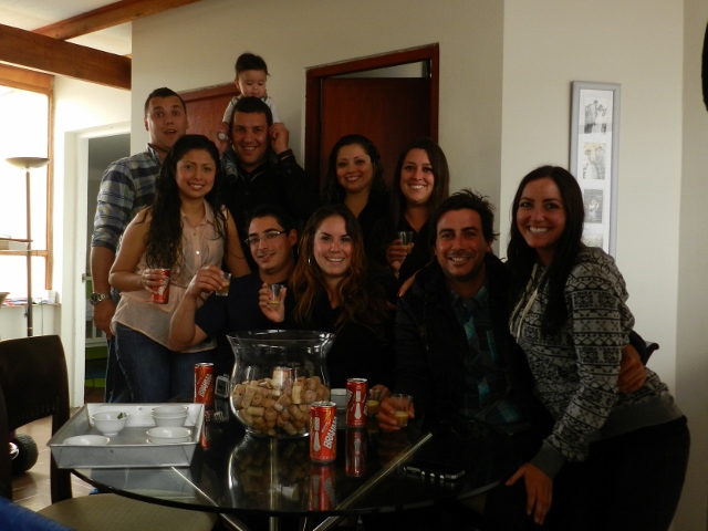
It also turns out I have family in Buenos Aires- how nice! We got in touch with Valentin, who I will call my cousin although I am still not entirely sure how we are related. But it doesn’t matter, family is family. Valentin took us for a night out in Palermo, a beautiful, fun, artsy part of Buenos Aires. We toasted our final fernet and colas, pretty much Argentina’s national drink (besides wine of course), and enjoyed one last night out.

DSCN8110 (640x480)

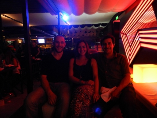
Thanks for a fun night out Valentin!

The long cab ride to the airport in the morning was surreal. It was so hard to believe that our adventures were coming to an end (for now…) and we were finally going home! Let’s see how we adjust to being back in the “real world” as everyone likes to call it. Wish us luck!

Categories: Argentina, Chile | Tags: , , , , , , , | 4 Comments

Adventures with Friends in Patagonia

Futaleufu, Chile- the place where three adventures converged into one. It was there that we met up with our good friends George and Teresa of Road Adventure and our new friends Joe and Kylee of Patagonia or Bust. George and Teresa began their trip in Seattle, Washington a year and a half ago. We first ran into them back in Columbia and met up again in southern Ecuador. Joe and Kylee are from Hood River, Oregon and have been traveling in a cool custom made truck since October 2012.

We wasted no time in finding a lovely campsite along a river, popping open a box of wine, and cooking up a scrumptious campfire macaroni and cheese dinner- the first of many delicious meals shared.

DSCN6030 (640x480)

Camping with friends is the best

DSCN6039 (640x480)

Dutch oven magic

DSCN6051 (640x480)

Baked mac n cheese, sauteed carrots, and avocado salad

And so began our joint adventure down the Carretera Austral through wild Patagonia. We caravaned along the dusty dirt road, through forests, past rivers, lakes, and waterfalls, camping wherever we pleased amidst the spectacular scenery.

DSCN6121 (640x480)

Lago Yelcho on a beautifully clear day

DSCN6125 (640x480)

DSCN6140 (640x480)

Camping alongside the ocean in Puyuhuapi

Each day we would do a few hours of driving while stopping along the way to fish, pick fresh berries, and to marvel at our surroundings.

DSCN6208 (640x480) (2)

Hunter or gatherer?

DSCN6223 (640x480)

The windy Cuesta del Diablo

DSCN6230 (640x480)

Stopping to enjoy the views at a mirador of Cerro Castillo

DSCN6232 (640x480)

A welcome stretch of pavement

On the Chilean side of Lago General Carrera, an enormous lake shared by Chile and Argentina, we slowed down for a few days to explore. Most visited in this area is the famed marble cathedral- an incredible formation of soft blue caverns sculpted by water. Finely ground glacial silt gives the lake its unbelievable azure color as it reflects dazzling light onto the walls of marble creating a surreal spectacle.

DSCN6329 (640x480)

Too many hues of blue

DSCN6262 (640x480)

Fishing on Lago General Carrera

DSCN6272 (640x480)

Then came one of the most beautiful stretches of the Carretera Austral- the road to Glaciar Exploradores. We drove the dusty road to its end, past mountains, glaciers, and spectacular scenery until we reached a river where we had heard whispers of giant salmon in the waters.

DSCN6445 (640x480)

The caravan

DSCN6449 (640x480)

The crew

Aron, George, and Joe caught a ride across the river in a little boat to a tiny dock while the ladies hung back in hopes of fresh fish for dinner. We were more than a little surprised when the guys came back with an enormous salmon! After cooking it up on a fire that evening the three of us couples had more salmon than we could eat for days. Salmon sandwiches, salmon pasta, salmon and eggs, even salmon sushi- we really lived it up in Patagonia.

DSCN6478 (640x480)

Hunters or gatherers?

DSCN6482 (640x480)

Riverside fish cleaning

DSCN6515 (640x481)

Driving around Lago General Carrera

We followed Lago General Carrera all the way around until we crossed the border into Argentina where the lake is known as Lago Buenos Aires. Once in Argentina, we had our first taste of pampa- flat, dry grassland that stretches as far as the eye can see. The comical shrubs and the abundance of wildlife kept us entertained during a two day drive to El Chalten, a base town for the remarkable Mount Fitz Roy. We saw armadillos, hundreds if not thousands of guanaco– a sort of llama type animal, and rheas which are like small ostriches.

DSCN6603 (640x480)

Middle of pampa camp spot after a long day of driving

DSCN6594 (640x480)

A fuzzy armadillo scampering across the road

When Mount Fitz Roy came into view in the distance we were in awe. The granite towers stood out spectacularly against the blue sky.

DSCN6649 (640x479)

Upon arriving in El Chalten we packed our bags and hoped for good weather as we set out for a three day hike that would take us to the base of Mount Fitz Roy. Through mossy lengua forests and up wind blasted ridges we wandered until we were right below the rock towers. The water in the rivers along the trail is sparkling clean as it flows directly from the glaciers that top the mountains. It was a blissful experience to be able to drink pure water directly from a stream. It reminded us of how precious these last pristine places in the world are and how important it is to preserve them.

DSCN6759 (640x480)

Sheltered from the wind in a mossy lengua forest

DSCN6680 (482x640)

DSCN6694 (640x480)

DSCN6714 (640x480)

At the base of the towers

Luckily the weather held up during our hike and then unleashed with torrents of rain and wind as we arrived back in town. With not much to do in the rain, we hopped in ours cars after a much needed hot shower and some pizza and headed south for El Calafate, the gateway city to the famous Perito Moreno glacier. We slowed down a bit and found a nice campground in the center of the city where we grilled empanadas and more of Argentina’s famous meat- lots of ribs in particular thanks to George, the rib master.

DSCN6774 (640x480)

Hamburger party

We were blessed with another gorgeous day when we set out to see the glacier. The Perito Moreno glacier is famous for it’s size, the enormous ice chunks that break off and thunder into the lake below, and for its accessibility. You can get right up close and appreciate the massive size of the twenty story glacier, and that’s just whats above the surface of the water. The glacier moves forward up to two meters per day. As it creeps between the mountains enormous pieces of ice, some the size of houses, come crashing down creating huge waves in the lake.

DSCN6933 (640x480)

DSCN6836 (640x480)

A tourist boat provides a little perspective of the size of the glacier

We spent all day gawking at the glacier, strolling along the walkways and hanging out at the different viewpoints. Seeing such beautiful, diverse, and awe inspiring landscapes just doesn’t get old. Even after fourteen months of traveling, nature never ceases to amaze us.

Categories: Argentina, Chile | Tags: , , , , , , , | 1 Comment

The Carretera Austral

The Carretera Austral is a mostly dirt and gravel highway that traverses 800 miles through Chilean Patagonia. The road is rough, windy, and dusty but the scenery it winds through is unparalleled. Never in our lives have we seen wilderness as majestic as this. Our friends from Oregon described it as the American North-West on steroids. Crystal clear rivers, lakes bluer than imaginable, pine and beech covered mountains, and craggy, snow covered peaks were a part of our everyday scenery.

DSCN5018 (640x480)

Making our way into Southern Chile’s lakes district, we stopped at Parque Nacional Conguillo, famous for the giant cone of Volcan Llaima towering over a forest of monkey puzzle trees out of a Dr. Seuss book. We camped alongside a beautiful glacial lake surrounded by snowy mountains and hiked up a ridge where we enjoyed magnificent views of the park.

DSCN4772 (640x480)

Wild camping at its finest

DSCN4753 (640x480)

Volcan Llaima

DSCN4853 (640x480)

View of the park from the Sierra Nevada trail

Chile’s lakes district has a huge German influence. Back in the 1800’s the Chilean government opened the remote south to Germany for settlement, providing land in exchange for the development of agriculture and forestry in the region with European technology. For an example of how prevalent the German influence is, all of Chile and Argentina use the German word for cake- “kuchen” (pronounce koo-hen). We stopped for some coffee and kuchen in the lovely lakeside German town of Frutillar, then continued around the lake to Puerto Varas to stock up on food and send out Christmas cards before heading into the wilderness of the carretera austral.

DSCN4928 (640x480)

Kuchenladen- German for cake shop

DSCN4926 (640x480)

Apple strudel- a taste of Germany in Chile

DSCN4931 (640x480)

There’s always time to stop and smell the roses

DSCN4946 (640x480)

Feeling the Christmas spirit in Puerto Varas

DSCN4941 (640x478)

Beautiful old architecture on the road between Frutillar and Puerto Varas

Our first stop on the carretera was Cochamo Valley, known as the Yosemite of South America. The sides of the river valley are covered in virgin temporate rainforest and old Alerce trees encompassed by giant walls of granite drawing climbers from around the world. We backpacked into the valley and spent three days fishing, swimming in the frigid river, and hiking up the steepest trails we have ever encountered. So steep in fact that one hike involved steel cables and climbing ropes to get up sections of slippery granite rocks.

DSCN5030 (640x480)

The pretty town of Cochamo

DSCN5062 (480x640)

Hiking into Cochamo Valley

DSCN5097 (640x480)

The granite domes of Cochamo

DSCN5160 (640x480)

Backcountry transportation

DSCN5137 (480x640)

A very steep climb- going down was almost scarier!

DSCN5123 (640x480)

At the top of the valley

From Cochamo we drove the dusty road to its temporary end in Hornopiren where we loaded the van on a ferry to cross the fjord to where the road begins again. The carretera is broken up by a road-less section of Parque Pumalin, one of the largest private parks in the world created by Doug Tompkins of The North Face. Tompkins started buying tracts of land in Patagonia in the 1990’s in order to protect it from exploitation and turned it into a giant conservation project, the result of which is beautiful Parque Pumalin.

DSCN5236 (640x480)

The pier in Hornopiren

DSCN5243 (640x480)

A gorgeous ferry ride from Hornopiren through Parque Pumalin

Parque Pumalin encompasses an area of temperate rainforest, like a jungle but in the cold south. Ferns, bamboo, and giant leaves of rhubarb perforate the forest floor between the trees. We had luck with the weather and camped on the way to Volcan Chaiten at one of the most scenic campgrounds we have ever been to. The volcano erupted just a few years ago in 2009, spewing hot ash for miles around. The barren landscape of dead trees and the slowly recovering town of Chaiten remain evidence of the destruction.

DSCN5331 (640x480)

El Volcan campground in Parque Pumalin

DSCN5381 (640x480)

Smoky Volcan Chaiten

Christmas brought rain but luckily we were at a campground with a nice shelter and we celebrated with wine, homemade pizza, and the last episode of Game of Thrones season three. It was a lovely Patagonian Christmas but after two Christmases away from home we are looking forward to spending the holidays with family again!

DSCN5411 (640x480)

Christmas Eve sunset

The weather cleared as we arrived in Futaleufu, a cute little town on the Futaleufu river, one of the top three whitewater destinations in the world. It is the bluest, most raging river we have ever seen and somehow we ended up rafting it… The class five rapids were a little intense for us river amateurs but we had a blast! The area is also a haven for fishing and hiking- we had a hard time leaving this beautiful place.

DSCN5459 (640x480)

The town of Futaleufu

DSCN5463 (640x480)

The incredibly blue Futaleufu River

IMG_0384 (640x427)

Braving the rapids

DSCN6074 (640x480)

On top of Piedra del Aguila- Eagle Rock

DSCN6103 (640x480)

Fishing for rainbow trout in the Futaleufu River

Futaleufu is only fifteen minutes from the border of Argentina so we wandered across to explore a little of the Argentinian lakes district while we waited for some traveling friends to catch up with us.

DSCN5530 (640x480)

DSCN5704 (640x480)

The first things we noticed about Argentina was the delicious food and the cheap gas. After scarfing down some freshly baked pastries and filling up our tank, we headed out to Parque Nacional Los Alerces. No hiking here because it rained for days but Aron caught his first sizeable Patagonian trout!

DSCN5564 (640x480)

DSCN5571 (640x480)

For New Years we camped in the cool, hippy town of El Bolson backed by a jagged toothy ridge of mountains. We grilled pizza over a fire (our holiday specialty) and shared our first Fernet with some new Argentinian friends. Fernet is a liquor similar to Jaegermeister, made of herbs and spices including rhubarb, camomile, cardamom, and saffron and is very popular in Argentina- we jumped right on board.

DSCN5643 (640x480)

Cerro Piltriquitron in El Bolson

DSCN5620 (640x480)

Early morning at a mirador over El Bolson

The feria – market – in El Bolson was a treat, just like the market back in Ocean Beach, San Diego that I miss so much. Freshly made jams with raspberries from the surrounding mountains, cool wood carvings, homemade cakes and cheeses, and delicious food- I was in heaven. We wandered around sipping local brewed beer and enjoying the live music.

DSCN5660 (640x480)

DSCN5588 (640x480)

DSCN5609 (640x480)

We mosied on up the Ruta 40, Argentina’s famous highway that runs from north to south through the entire country passing desert, pines, and pampa. We camped alongside beautiful lakes and did some hiking in Parque Nacional Nahuel Huapi, Argentina’s oldest Nacional Park. The hike up to Refugio Lopez, a mountain refuge, passed through dense forest home to comical woodpeckers and revealed gorgeous views of the lake below.

DSCN5714 (640x481)

DSCN5804 (640x480)

Refugio Lopez overlooking Lake Nahuel Huapi

DSCN5811 (480x640)

Woody the woodpecker

In the southern section of the park we visited Mount Tronador, a snowy beast that got its name from the thundering of ice chunks falling down its slopes. Instead of heading up into the snow we hung out along the rivers where Aron fished for trout and I figured out how to bake bread on our camp stove (success!).

DSCN5942 (640x480)

Mount Tronador

DSCN5885 (640x480)

Lago Mascardi

While I was baking in the van Aron ran up with a rainbow trout in his hands that he had wrestled out of the river. A little lemon and garlic and voila- dinner is served!

DSCN5882 (480x640)

DSCN5910 (640x480)

DSCN5904 (640x480)

Chile and Argentina have turned out to be some of the best countries for traveling in the van. The landscape is breathtakingly beautiful, there are campgrounds and places to wild camp everywhere, and good vibes abound. We can’t even remember the last time we stayed in a hostel. Our little house on wheels is all we need when the outside is this gorgeous!

Categories: Argentina, Chile | Tags: , , , , , , , , | 3 Comments

California Dreamin in Chile

We were told that central Chile is like California 50 years ago and when we saw it for ourselves we understood why. The coast is lined with endless rocky points creating the perfect setup for waves but with hardly anyone around. Wildflowers blanket the fields while pine trees stand majestically on cliffs overlooking the sea. It was like an uncrowded slice of home on the other side of the planet.

Leaving Chile’s dry northern coast behind, we meandered down the sunny central coast, looking for waves and camping at beautiful little beach towns all along the way. In the quaint town of Maitencillo, we camped in the sand among a carpet of purple, orange, and yellow wildflowers.

DSCN3902 (640x480)

The bigger city of Concon had some fun beachbreak and giant mouth watering made to order seafood empanadas with loco, razor clams, and crab.

DSCN3962 (640x480)

DSCN3948 (640x480)

Have you ever seen empanadas this big?!

We saw our first penguins in Concagua, hopping and waddling around on a rocky island just off the coast. We’re hoping to see lots more of these little buddies when we get further south!

DSCN4132 (640x480)

The funky, artsy city of Valparaiso happens to be the sister city of Long Beach as we learned from a sign at a mirador. Valparaiso is a big port city but the hills that rise up from the coastline contain a scramble of cool ramshackle houses with art covering nearly every wall. We wandered up and along the steep streets checking out the art and enjoying the beautiful views of the city below. It was sort of reminiscent of San Francisco, except instead of trolleys Valparaiso has old ascensores, carts on a track that have been rolling people up the steep hills since the late 1800s.

DSCN4055 (640x480)

DSCN4053 (480x640)

DSCN4070 (640x480)

DSCN4050 (640x480)

While camping on the coast we ran into Dean and Vivian, a couple from Texas traveling in a huge truck converted into a house on wheels. Happy to have some companions for the holidays, we shared a wonderful Thanksgiving with them at a nice campground in Vina del Mar. Although we couldn’t find any form of cranberry sauce or a proper turkey, we made do with pan cooked corn bread (we really miss having an oven!), mashed potatoes, salad, corn, chicken, and for desert- bananas foster.

DSCN4117 (640x480)

Happy Thanksgiving!

DSCN4122 (640x480)

After recovering from our Thanksgiving feast, we drove a few hours north for a VW camping event organized by a group called Kleinbus. When we arrived in the evening we were happy to see our friends David and Andrea from Mexico who are also traveling in a van and had told us about the event. At around midnight the caravan of vans from Santiago arrived. They putted into the campground one after another and scooted into campsites among the trees like little bugs. We spent the weekend grilling, checking out the vans, torturing people with our bad Spanish, and drinking jote – a Chilean favorite of cheap red wine mixed with coca cola.

DSCN4169 (640x479)

Kombis unite!

DSCN4175 (640x480)

DSCN4192 (640x480)

On the last morning the vans lined up on the beach for some classic photos, 32 vans in all!

DSCN4244 (640x480)

DSCN4278

Next up we headed to Pichilemu- Chile’s surf central. Host to a number of waves, the best is just five minutes south of town in Punta de Lobos. The waves here get enormous certain times of the year and the spot hosts numerous surf competitions. When we were there it was not yet summer so it wasn’t overly crowded and the waves were a good size.

DSCN4401 (640x480)

Punta de Lobos

DSCN4414 (640x481)

We came across an awesome camping spot in Punta de Lobos owned by Anton, a hilarious snowboarder from Oregon. It just so happened that two other groups of people from San Diego were staying there as well so we joined forces and barbecued each night while enjoying more of Chile’s cheap fine wine. Aron was stoked to have some friends to surf with and I was ecstatic to have some girlfriends!

DSCN4352 (640x480)

View from Anton’s place

DSCN4347 (640x480)

Enjoying some after surf beers

DSCN4355 (640x480)

DSCN4417 (640x481)

DSCN4447 (640x480)

The crew at Punta de Lobos

After the morning surf we would drive into town for some more of those amazingly fresh hot Chilean empanadas. We caught the weekly market and bought fresh strawberries, cherries, and avocados, all local, in season, and super cheap. We have been living on avocados and apples in Chile, two of the most abundant things grown here. Six avocados for a dollar- yes, heaven!

DSCN4372 (640x480)

Casa de las Empanadas, the best empanada spot in town

DSCN4373 (640x480)

Can’t get enough of those molten lava filled empanadas

From Pichilemu we set out to explore the rest of Chile’s prime surf coast. We stopped for a night at this spot that Anton calls crabslaughter. Aron surfed some fun waves in the evening and we camped on a hill overlooking the friendly little fishing village.

DSCN4494 (640x480)

DSCN4504 (640x480)

DSCN4492 (640x480)

Our favorite spot was Buchupureo, a tiny, beautiful town with a central square surrounded by only four blocks of houses. We camped in the beach parking lot with cliffs of pine trees in the background and the ocean out front. Aron loved this cold left hander and got it realllly good one day.

DSCN4676 (640x480) (2)

Buchupureo

DSCN4662 (640x480)

DSCN4680 (640x480)

Back in Barra de la Cruz, Mexico three months into our trip we met Ana and Santiago, a couple of Chileans traveling north to Alaska. We made plans to meet up in Chile down the road and somehow everything fell into place nearly a year later. We met up with them in the little town of Curanipe where Aron and Santiago surfed the point break while Ana and I bought fresh fish at the local seafood market and made a lovely dinner.

DSCN4561 (640x480)

The next morning, we drove out to their farm about an hour inland from Curanipe. Don Santiago, as he is known on the farm, studied agriculture and is running a large farm with all sorts of different crops and a huge irrigation system. Ana has a beautiful garden full of onions, lettuce, beets, peppers, and tomatoes. We saddled up some horses and went riding through the farm in the hot afternoon sun, past rows of corn, oats, and sunflowers- it was a lovely afternoon.

DSCN4590 (640x480)

Ana and Santiago’s beautiful farm home

DSCN4591 (640x480)

Touring the farm

Don Santiago had promised the workers on the farm a big asado – a meat filled bbq – after they had gotten the farm up and running. After the days work he returned with an entire lamb and pig, both of which were roasted over charcoal on an enormous grill. The workers were so excited for all of the meat that they refused even a taste of the side dishes that Ana and I prepared. We were the first foreigners the farm workers had ever met and they thought we were pretty hilarious.

DSCN4613 (640x480)

With our journey nearing its end, we have been debating whether or not to sell the van to avoid the money and hassle of shipping it back to the states. We posted online to see if there was anyone interested out there and that’s how we had the pleasure of meeting Ben and his family. Ben is a geology professor from California who is teaching at a university in Chile and wanted to buy the van to roadtrip back to the states. Ben and his family welcomed us into their home and spoiled us with homemade sushi, mac and cheese, and pumpkin pie while we sorted out the details of the sale.

DSCN4551 (640x480)

Dillon and Cana working their magic in the kitchen

At the last minute when Ben and Aron went to the customs office to do the final paperwork, they hit an impassable barrier and the sale turned out to be impossible. Long story short, Ben is in Chile on a temporary resident visa and Chilean residents cannot own foreign used vehicles. So here we are, still traveling in the van, broke but happy. We truly believe that everything happens for a reason and are grateful to still be on the road in our little house on wheels! We wish Ben and his family all the best in their travels as well and are happy to have met them. Next up- Patagonia!

Categories: Chile | Tags: , , , , , , , | Leave a comment

Keepin it Simple

Crossing from Peru into Chile was like a breath of fresh air. We loved Peru- the mountains, the llamas, the food, the ancient ruins, the kind people we met… but somehow it was the most difficult country on the trip for us. The overall vibe in many places we visted was a little sketchy and we felt that we always had to be extra careful with our belongings, with the van, and with where we camped. Maybe it’s just us, or maybe it was that I was mugged on the beach within hours of being in the country, but from speaking with other travelers it does seem that unpleasant incidents may be more common in Peru than other countries we have been to. I won’t even get started on the insane driving, the piles of trash everywhere, and the packs of stray dogs on top of those piles of trash. But enough of the bad, Peru is an absolutely amazing, adventurous, breathtaking country and before we knew it we had spent two months just skimming the surface.

Being in Chile feels a lot like being in California to us, from the landscape to the orderliness and modernity. In fact, we couldn’t help comparing every place along the coast of Chile to the coast we know back home. Northern Chile’s dry desert coast is very similar to Baja California and sits at the same latitude except in the southern hemisphere. As we made our way south, the dry Baja California landscape gave way to the scrubby chapparal landscape of southern California. It was like being home but opposite and we loved it.

Our tour of Northern Chile started with a few days of free camping on the beach in Arica, a dry city just half an hour south of the border with Peru.

DSCN3346 (640x480)

We checked out the waves which included miles of decent beach break and a heavy wave called “El Gringo” or “The Chilean Pipeline” that barrels right over rocks off a small island connected to the land by a jetty. This was Arons first surf after a month in the mountains and he managed to snag a few but took a thrashing along with a body boarder who came out with a shredded wetsuit after his first wave. Ouch.

DSCN3322 (640x479)

El Gringo on a small day

When the waves dwindled we took a walk up to “El Morro”, a museum and memorial on top of a steep hill overlooking Arica commemorating an important battle of the War of the Pacific (1879-1883) fought between Peru, Bolivia, and Chile. Before the war, Peru and Bolivia owned much of northern Chile (see map below). Long story short, Chile won the war and gained both these territories along with access to valuable mineral deposits such as nitrate and copper. Nowadays the north of Chile is home to lots and lots of mining, particularly copper which is one of Chile’s largest exports.

War of Pacific

Thanks Wikipedia

DSCN3364 (640x480)

Looking over Arica from El Morro

From Arica we headed south to Iquique, another happening coastal city known for it’s enormous duty free zone where everything from cars to camping gear is sold. Iquique is almost like downtown San Diego with high rise condos and such but with waves right in front. The beaches and the boardwalk that stretches around them invite all kinds of happy people out and about to surf, body board, skateboard, roller blade, ride bikes, jog, and walk their dogs in cute little sweaters. It was nice to see people with time for hobbies, just enjoying the beach and a nice sunny day.

DSCN3404 (640x480)

Sunday beach day in downtown Iquique

We were having some problems with the van so we ended up stuck in Iquique for a week but we didn’t suffer much. Aron surfed every day and I ran on the boardwalk and swam in the ocean between visits to the mechanic. We found some nice mechanics that let us use their shop space and tools so we could diagnose why the van was acting up. Turns out the problem was a stuck intake valve that we think got gunked up from the dirty gas we’ve been running with for a year now. Luckily we had the help of Chris from Vanistan who re-built our engine before the trip. Following his advice, we added automatic transmission fluid into the gas and the oil in hopes that the high level of detergents would de-gunk the fuel valves as it ran through the engine after a few hours of driving. Perhaps that´s a little too much information- still awake?

While driving the van around trying to bathe the fuel valves, we discovered El Verde, a little fishing village half an hour south of Iquique consisting entirely of cheap seafood stands serving fresh ceviches and all kinds of delicious stuffed seafood empanadas made with fish and mariscos harvested directly from the ocean out front. We sat down at the first stand and started chatting with the Bolivian couple running the place as we munched on our fresh, hot crab and cheese empanadas. They insisted that we try loco, a sort of a Chilean abalone, and treated us to a plate- it was absolutely delicious! Seafood in Chile rocks.

DSCN3432 (640x481)

Fresh seafood straight outta the ocean

DSCN3428 (640x480)

Loco, strange looking but it tastes really good!

After eleven months on the road our money is starting to dwindle, but luckily we have been able to do lots of free camping in Chile. At the end of the days spent in town working at the mechanics, surfing, running errands, and using the internet, we would drive ten minutes south of Iquique to camp each night at Playa Blanca with the lulling tide just outside of our windows.

DSCN3426 (640x480)

Once we were certain the van engine wasnt a ticking time bomb, we made the long haul inland to the town of San Pedro de Atacama in the Atacama desert, the driest desert in the world! We spent a day touring the sights in the area which include lakes, volcanos, salt flats, flamingos, and trippy looking stone formations. We started our tour at the Salar de Atacama, the largest salt flat in Chile.

DSCN3476 (640x480)

This expansive, salty lagoon was absolutely surreal. The white salt beneath the water and all around the shore together with the bright hot sun made for a brilliant, dreamy sight. When we pulled up there was nothing around but a lone flamingo strolling through the shallow lagoon. We waded in the cool water, crunching salt beneath our feet until our skin started to hurt from the saltiness.

DSCN3559 (640x480)

DSCN3498 (640x480)

DSCN3529 (640x480)

Walking on salt bergs

DSCN3516 (640x480)The next lagoon we visited, Laguna Cejar, has a super high salt concentration comparable to that of the Dead Sea. You can see Aron floating like a cork in the photo below.

DSCN3577 (640x480)

We returned to town and hid from the sun during the hottest part of the day before heading out to see the famed sunset in the Valley of the Moon. We explored the valley in the still blazing evening sun and walked through a cool series of caves of crystallized salt that looked like glass. As the sun began to set and the moon began to rise, we hiked up to a viewpoint where we watched the desert sky turn pink and blue and cast shadows across the landscape.
DSCN3655 (640x480)

DSCN3592 (480x640)

Crystallized salt caves

DSCN3711 (640x481)

Sunset in the Valley of the Moon

Our original plan was to continue east from San Pedro de Atacama and cross into Argentina, but when morning came we decided we weren’t ready to leave Chile or it’s beautiful coast. So… back to the beach! We returned to the coast near Antofagasta, a mining town of not much interest other than waves for Aron but just north we stopped to see La Portada, a beautiful natural arch in the sea.

DSCN3725 (640x481)

La Portada

Chile’s dry northern coast began to give way to little shrubs and cacti as we headed to Parque Nacional Pan de Azucar, a beautiful coastal preserve of rocky outcrops, sapphire water, white sand beaches, and an offshore island home to hundreds of Humboldt penguins. As the sun went down we found a nice campground run by a kind lady who sold us a giant bottle of wine and gave us all the firewood we could want, the makings of a perfectly lovely evening.

DSCN3805 (640x480)

DSCN3823 (640x480)

DSCN3826 (640x480)

From Pan de Azucar we slowly meandered down the coast, checking every surf spot Aron had ever heard of and stopping at all the beautiful lookouts and beaches we passed. We wild camped on the beach whenever we found a nice spot which was practically everywhere on this wide open unpopulated stretch of Chilean coast.

DSCN3751 (640x480)

Out of the many surf spots we checked out, Portofino was the best. Portofino is a tiny little town of just a handful of houses on an empty stretch of coast. The wave is a peeling left point and was working perfectly when we arrived. Aron jumped into the water and helped himself to wave after wave being the only one in the crystal clear water. You should have seen the smile on his face.

DSCN3841 (640x480)

DSCN3864 (640x480)

Further south near the big city of La Serena, we couldn’t find any freebie beaches to camp at but we did find the nicest gas station we have ever seen. Copec is Chile´s national gas station and they are everywhere. Many have hot showers, clean bathrooms, and even a cafe with wifi. This one had all of the above, plus a view of the ocean. We parked in the large lot in the back, overlooking the ocean along with a couple of giant trucks. We are convinced it’s the most scenic truck stop in the world.

DSCN3888 (640x480)

Camp Copec

DSCN3898 (640x481)

Ocean view luxury

That night our dinner in the van consisted of ramen and a can of choritos (mussels), one of our favorite Chilean discoveries, and we laughed at where we are after a year of traveling. Chile is expensive, with camping, hostels, and restaurants costing three times as much as in other countries we have visited. The only cheap thing in Chile is the wine, which nearly makes up for everything else. And did I mention gas costs $6.50/gallon or more? So, needless to say, we try to make up what we can by free camping as much as possible and by not eating out (although we do indulge on empanadas here and there, they are too good here in Chile to pass up). All in all, living the simple life in the van in Chile is pretty darn sweet.

DSCN3892 (640x480)

Crackers and hot sauce and you have yourself a meal.

Categories: Chile | Tags: , , , , , | 6 Comments

Sacred Valley Magic

After saying goodbye to our pals Benny and Crystal, we headed back into the Sacred Valley to do some strenuous hiking with Johnny and Patty. On the way to the town of Ollantaytambo where we would start our three day hike, we stopped to see Salinas de Maras, a vast kaleidoscope of salt pools.

DSCN2695 (640x480)

DSCN2703 (640x480)

DSCN2733 (640x480)

Mmm, salty

The folks that have been harvesting salt here since Pre-Incan times carved a series of earthen pools into the side of the mountain to catch the salt from a warm, saline underground stream that flows down the valley. As the water evaporates from the ponds, salt crystals deposit at the bottom and on the sides of the pools and is then scraped off and dried. There are over 3,000 individual pools here!

Our next stop was Moray, a set of Inca agricultural ruins that form a magnificent set of concentric terraced circles. Apparently, the temperature from the top level to the bottom most circle can differ by more than 25 degrees Fahrenheit, leading to the belief that these terraces were possibly used to experiment with growing various crops, like an agricultural laboratory.

DSCN2742 (640x480)

In the evening we arrived in the beautiful little town of Ollantaytambo, nestled in a valley below the remains of an Inca fortress. After a good nights sleep in the van, we set off for the three day hike through the Sacred Valley. We walked along train tracks paralleling a river before climbing up into the hills and passing through isolated villages full of mud houses and friendly villagers. Before long we zig zagged steeply up and out of the valley past farms of corn and potatoes until we reached some ruins atop a waterfall where we would spend the first night. The view of the valley below from the ruins was spectacular and the sky graced us with a rainbow during the hardest part of the climb. We set up our tents inside the walls of the crumbling ruins that sheltered us from the wind while we slept peacefully.

DSCN2793 (640x480)

The Sacred Valley

DSCN2800 (640x480)

Sharing a bedroom with Inca spirits!

DSCN2831 (640x480)

View of the ruins and our campsite from above

Awaking with the sun in the morning, we set off after coffee and oatmeal for the most difficult day of the hike. We continued to climb up, and up, past herds of sheep tended by little old ladies until the scenery changed to golden high altitude grasslands.

DSCN2863 (640x480)

Around 14,000 ft

DSCN2890 (640x480)

DSCN2870 (640x481)

The Sacred Valley below

We stopped to make some lunch on a steep, narrow part of the trail with beautiful views of the valley far below. While we sat there eating egg salad sandwiches, a condor appeared out of the clouds below us, and slowly flew right over us, just cruising by to check us out. He was so close that we could see the detail of the white collar around his neck, his finger-like wingtip feathers, and could appreciate his magnificent size. It was magical! Andean condors can reach wingspans of more than three meters in length and are pretty rare. I was too captivated to even think about scrambling for my camera but here is what they look like:

Andean Condor

Shortly after the magical condor moment we started to descend into another valley. As we carefully walked down the steep, rocky path the clouds parted to reveal gorgeous views of the surrounding snow capped mountains.

DSCN2930 (640x480)

As the sun set, we still hadn’t reached the second camp site so we continued on with headlamps and managed to find our way down through the dark. After eight hours of hiking, we made it to camp just as it started to rain. Success! Luckily our tents kept us pretty dry and the next morning was just a little three hour walk back to Ollantaytambo.

Back in town, we were greeted with Ollantaytambo’s annual festival full of music, dancing, food, drinks, and brilliant colors. We gathered in the central square along with everyone who journeyed from all the small towns in the surrounding area to join the festivities. Each village had its own local costume and traditional dance to the sound of live Andean flute music.

DSCN3030 (640x480)

Watching the festivities in Ollantaytambo below ancient Inca ruins

Some dances represented the planting and harvesting of the ever important potato, while one of our favorites was the dance of the condor, an animal sacred in the Andes. In Inca mythology, the three levels of existence are represented by the condor (the heavens or upper world inhabited by superior gods), the puma (the earthly world), and the serpent (the underworld and spirits of the ancestors).

DSCN2977 (640x480)

DSCN2985 (640x480)

DSCN2979 (640x480)

DSCN3105 (640x480)

This beautiful preservation and continuation of ancient Peruvian culture was moving to witness and we felt so lucky to see it all come alive. The colors, the music, the dancing, the smiles, all opened our hearts to a part of Peru we hadn’t yet experienced and will always remember.

Categories: Peru | Tags: , , , | Leave a comment

Hanging with Peruvians- Lima to Machu Picchu

As we hopped in the van to drive to Lima we felt like kids before Christmas- Benny and Crystal were coming to visit! Our good friends from California were going to be the first familiar faces from home in over 10 months. To top it off, Benny’s mother is from Peru and much of her family still lives in Lima. Time to get down with the Peruvians!

DSCN1965 (640x480)

Just a little excited

DSCN1969 (640x537)

Aron and Benny, together again

Lima is known as the gastronomic capital of South America, so of course during our week in Lima we did a lot of eating.  A few food experiences were so amazing that they made me re-evaluate some of my favorite things. We ate sushi as good as the sushi at Taiko, a restaurant in Irvine, California that until this moment nothing has compared to. We had ceviche that we thought better than the ceviche in Mexico, something I didn’t think possible. We had some of the best sandwiches in the world. We went to the Chocolate Museum where we sampled chocolate liquor and ate a terremoto (earthquake), the most extraordinarily decadent chocolate mouse and brownie dessert ever (Monique, you would have died). And we ate anticucho, otherwise known as cow hearts- yes, even me and I kind of liked it!

DSCN1992 (640x481)

Some of the most delicious sandwiches in the world

DSCN1978 (640x480)

Handmade chocolates at the Choco Museum

DSCN1976 (640x480)

A terremoto, an earthquake of chocolaty goodness

DSCN2090 (640x480)

Benny’s cousin Giovanni diving into a meat bonanza. The cow heart is on the skewers at the top of the massive pile of steak, liver, sausage, and intestine.

One Saturday afternoon, Benny’s cousin Giovanni, a professional chef, cooked an eight course Peruvian meal for us so we could sample a some of Lima’s famous culinary delights. We started off with maracuya sours, a delicious traditional Peruvian alcoholic beverage made with pisco (grape brandy), sugar, egg white and fresh maracuya (passion fruit) juice. The highlight of the meal was the three types of traditional ceviche made with fresh fish and octopus and the simple combination of lime, salt, onion, and different types of aji (hot chile) that make Peruvian ceviche so amazing.

DSCN2134 (640x480)

Chef Giovanni working his magic

DSCN2128 (640x480)

Going to miss this family!

We also had a chance to meet up with the VW Club of Lima thanks to our new friend Miguel who magically found us. He rallied up a group of Westy’s and Vanagons including another couple from California traveling with their two year old daughter. Go Westy’s!

DSCN2108 (640x480)

We sadly had to say goodbye to Benny’s wonderful family in order to get a start on the three day drive to Cusco where we would start our adventure to Machu Picchu. To break up this road trip within a road trip, we stopped for a wild dune buddy ride and some sand boarding in Huacachina, a little oasis town surrounded by enormous sand dunes.

DSCN2271 (640x480)

DSCN2199 (640x480)

DSCN2268 (640x480)

A quick stop at the world famous Nazca lines, a series of ancient geoglyphs representing plants and animals, was nice but underwhelming. After hearing theories that they were created by aliens, we expected them to be unfathomably big. Instead they turned out to be nice sized pictures created by removing dark surface stones to expose the lighter sand beneath. Still cool, but definitely doable by human hands. However, we only got to see the tip of the iceberg from a viewing tower on the side of the highway since one would have to take a bumpy plane ride over the desert to see more.

DSCN2279 (640x480)

El arbol- the tree

After endless driving up and down the Andes mountains we finally arrived in Cusco! A beautiful old city full of history, Inka stone lined streets, and tons of tourists. We hung out for a few days while figuring out an affordable way to get to Machu Picchu.

DSCN2312 (640x480)

DSCN2390 (640x480)

DSCN2384 (640x480)

Since the train (the most pleasant and common way of getting to Macchu Picchu) was prohibitively expensive for us, we decided to go with a $100 package that included a bus ride to and from Santa Teresa, the closest town to Machu Picchu reachable by road, two nights in a hotel in Aguas Calientes (the gateway to Machu Picchu), entrance to Machu Picchu (which is $50 in itself), a guided tour of the ruins, and meals. Along with Benny and Crystal, we joined forces with our friends Johnny and Patty of Wandaroundtheworld and their friend Kassy so that we might enjoy this adventure with good company.  The crammed 7 hour bus ride winded us up and over a high pass and included a final stretch of what I call death road to Santa Teresa, a super sketchy road dug into the side of a steep cliff. As we drove along the bus driver told us stories of people falling asleep at the wheel and cheerily had us peer over the edge at ghostly trucks far below in the rubble that had gone over the edge. Yikes.

After narrowly escaping death on the death road, we arrived in Santa Teresa. From there, we walked three hours along the railroad tracks until we reached Aguas Calientes, a pleasant but expensive place also known as Machu Picchu town because its existence is solely due to the location of Machu Picchu.

DSCN2404 (640x481)

Walking along the tracks to Aguas Calientes

A hot shower and bed put and end to the long day of traveling. We woke up at 4:30am to the sound of rain pounding on the tin roof of our hostel. We threw on our ponchos and rain gear and sleepily walked down the street to get in line for the bus up the mountain to Machu Picchu. Luckily we were able to catch one of the first couple of buses which got us to the ruins when they opened at 6am.

And all of a sudden there we were, standing in the mist at the ruins of Machu Picchu. Wow. It was even more amazing than we could have imagined.

DSCN2420 (640x479)

DSCN2434 (640x480)

DSCN2500 (640x480)

DSCN2464 (640x480)

DSCN2471 (640x481)

A hundred photos later, we started the hike up Machu Picchu mountain, overlooking the ruins and the surrounding valleys. It was like being on a stair climber for two hours straight, going up and up and up the steep, slippery stone steps. With the amount of times we all had to stop to catch our breaths we made slow progress but eventually we made it to the top where we could see the ruins in all their glory. The mountains surrounding the mountain that Machu Picchu is on are high enough to block the entire valley from outside view, keeping Machu Picchu super hidden. DSCN2566 (640x481)

DSCN2593 (640x480)

DSCN2588 (640x481)

Of course no visit to Machu Picchu is complete without a game of frisbee!

DSCN2638 (640x480)

Despite the expense and the extreme amount of floppy hat wearing tourists, the ruins as well as the setting of Machu Picchu are magical, beautiful, spectacular, magnificent, and every other superlative you can think of. We could have sat there all day gazing at the ruins below in awe. Being there with our friends from home really put our journey in perspective. Pretty crazy to think that we drove from San Diego to Machu Picchu!

Categories: Peru | Tags: , , , , , | 2 Comments

Trekking in the Peruvian Andes

After knocking the sand out of our hair and every other possible place from the dry, dusty coast of Peru we headed into the Andes mountains to do some power hiking! After a windy six hour drive past farms and apple orchards, we arrived in Huaraz, the base town for our hiking adventures in the Cordillera Blanca. Although anxious to get out of the hustle and bustle of Huaraz and into the peaceful mountains, we were advised to take it easy for a few days in order to acclimate to the 10,000ft altitude after arriving from sea level.

DSCN1413 (640x480)

On the road to Huaraz. The town is tucked down there in the valley with the peaks looming all around.

DSCN1421 (640x479)

The city of Huaraz with a view of some of the surrounding peaks

After two days of acclimating and stocking up on supplies in Huaraz, we drove past the little town of Yungay to Llanganuco Lakes, two beautiful blue lakes in a narrow mountain valley in the shadow of Mt. Huscaran, the highest peak in Peru. We stopped to admire Chinancocha Lake and drove along a narrow dirt road past Orconcocha Lake before we reached a grassy campground in the middle of a bunch of grazing high altitude cows. One of them actually ate our doormat while we were sleeping… Anyhow, we made a quick dinner as the sun set and the temperature quickly dropped before waking up early the next day to do a long day hike to Lake 69, one of the most beautiful sights in the Cordillera Blanca.

DSCN1464 (640x480)

Chinancocha Lake

DSCN1472 (640x481)

Orconcocha Lake

DSCN1655 (640x480)

Yurac Corral Campground

We set out hiking along the river in the valley before climbing higher and higher into the mountains. When the clouds cleared for a bit we could see the peaks of the some of the monstrous mountains around us, including the two peaks of Huascaran. In 1970, an earthquake caused a portion of Huascaran to collapse, sending a landslide of ice and rock down the valley and burying the entire town of Yungay below, killing 20,000 people – heavy stuff.

DSCN1520 (640x480)

DSCN1541 (640x480)

Huascaran’s two peaks momentarily visible through the clouds.

DSCN1581 (640x480)

Getting higher!

After four hours of spectacular scenery and shortness of breath, we were rewarded with the literally breathtaking sight of Lake 69. Purest of turquoise and seated below snowy peaks and glaciers, it was an unreal setting unlike anything we have ever seen before.

DSCN1583 (640x480)

Lake 69

The next day after resting our weary legs we drove back through Huaraz and into the mountains just outside the city to camp at The Hof Hostel. The Hof is a non profit that works with the Quechua indigenous community to spread the practice of sustainable building and permaculture. It also happened to be the perfect starting point for a number of hikes in the area- pretty darn cool.

DSCN1748 (640x480)

Camping at the Hof

With our new friend Philip from Wyoming (more commonly known as Onion), we set out to do another acclimatization hike to Lake Churup in order to warm up for a  tough three day trek that we would be starting together the next day.

DSCN1688 (640x480)

Road from the Hof into the mountains

DSCN1689 (640x480)

Aron and Onion

DSCN1701 (640x480)The hike took us steeply up to 14,600ft, so steep in fact that we had to climb a section of rock wall while gripping nervously to wire cables and trying not to slip.

DSCN1704 (640x480)

Trail to Lake Churup, which is tucked under that peak

DSCN1732 (640x480)

Just a little amateur rock climbing

DSCN1720 (640x480)

There’s another lake up there but the altitude got the best of Aron

DSCN1726 (640x480)

Lake Churup high up in a mountain bowl

After enjoying some lunch at the lake, we made our way back to the Hof to get some rest for the big excursion the next day. The three day trek would take us through Quilcayhuanca Valley, over a 16,660ft pass, and down through Cojup Valley back to the Hof with about nine hours of hiking each day. We set off early in the morning and enjoyed a leisurely section of the hike through the flat river valley dotted with grazing cows before starting to steadily climb.

DSCN1767 (640x480)

Quilcayhuanca Valley

DSCN1780 (640x480)

Cruzin along

DSCN1811 (640x480)

The start of a long climb up

The second day of the hike took us higher and higher until we reached the level of the snow and glaciers on the surrounding mountains.

DSCN1819 (640x480)

Not much O2 up here

DSCN1827 (640x480)

Then came the moment we had been dreading, climbing over the 16,660ft pass. Not only does this involve scrambling up a steep mountainside over loose rocks and debris with the chance of getting lost or falling to our deaths, but we had heard firsthand of other hikers getting altitude sickness or dealing with serious pounding headaches and disorientation here. Well, we had come this far and there was no turning back. As we climbed higher the air got thinner and colder. When we hit the scree, or section of loose rocks, we had to tread carefully in order not to go sliding down while nervously looking up at huge boulders on the steep ridge above, hoping that nothing would come loose and roll down at us. Not gonna lie, we are smiling in the photo below but it was pretty frightening.

DSCN1851 (640x480)

Almost at the top! Scrambling over shale to cross the pass at over 16,000ft.

Despite the height, the thin air, our fears, and the rocky terrain, we made it to the top! Our reward was a sense of accomplishment and spectacular views of the valley below. Anything is possible!

DSCN1857 (640x480)

On top of the world!

DSCN1864 (640x480)

View of Cojup Valley after crossing the pass

Categories: Peru | Tags: , , , , | 2 Comments

Nine Months, Ten Countries- Ecuador into Peru

After picking up our special coolant hose delivery from California and patching up the van, we decided to blow off the rest of the Ecuadorian coast due to the abundance of grey skies and lack of waves. Instead, we headed southeast to explore the high altitude lakes and paramo of Cajas National Park. When we reached the park after a long day of driving we both felt terribly nauseous and lightheaded. Perplexed by what it could be, we realized that in one day we drove from sea level up to 14,000 ft. That sort of abrupt elevation change can wreak havoc on the body.

Feeling better in the morning, we hiked through a section of the park in which we saw many beautiful lakes, wandered through forests of trippy looking quinua trees (paper trees in English), and even encountered some high altitude shaggy llamas.

DSCN0415 (640x480)

DSCN0433 (640x480)

DSCN0445 (640x480)

DSCN0456 (640x480)

DSCN0568 (640x480)

We didn’t last long in the bitter cold so we made our way down to the lower altitude portion of the national park where Aron fished for miniature trout along a beautiful creek as a herd of llamas looked on curiously.

DSCN0699 (640x480)

DSCN0624 (640x480)

DSCN0765 (640x480)

DSCN0769 (640x480)

Got one!

Ready for a hot shower, we drove the final half hour stretch to Cuenca, a beautiful university city of rivers and trees surprisingly full of American ex-pats. Without planning to, we spent nearly a week in Cuenca, camping at Cabanas Yanuncay alongside a river just outside the city center. When we weren’t strolling around the city, we were hanging out with chickens and eating fresh cherimoyas from the orchard on the property.

DSCN0902 (640x480)

Camping at Cabanas Yanuncay in Cuenca

DSCN0775 (640x480)

Street art along the river in Cuenca

DSCN0801 (640x480)

Cathedral and central square

DSCN0805 (640x480)

DSCN0810 (640x480)

Had to buy a handwoven basket from this sweet little lady

Our new friend Taylor (one of the students we stayed with in the Galapagos) and her now fiance Bassem (congrats guys!) happened to be in Cuenca at the same time, as were our friends George and Teresa of Road Adventure. The six of us piled into the van for a Sunday outing exploring the nearby villages and markets. Our first stop was the market in Gualaceo, famous for it’s roasted cuy (pronounced koo-ee), also known as guinea pig! Although extremely unappealing with their little claws and gaping mouths, we felt that we had to try one for the sake of the experience. George bravely stepped up and chose out the cuy on a stick that would be our lunch. The woman manning the coals brutally chopped it up and presented it to us on a paper plate. None of us were quite sure how to begin when I looked over and saw the woman next to us break off a crispy cuy ear and happily crunch it in her mouth. Dig in I guess! Although I only managed to try one little sliver, the overall verdict was that it tasted like chicken, but greasier and with less meat. Checked off the list… never again.

DSCN0853 (640x480)

Guinea pigs roasting over hot coals

DSCN0860 (640x480)

How about a little drumstick

DSCN0863 (640x479)

Market in Gualaceo

From Cuenca, we headed south into Peru, country number ten! As soon as we hit the coast and crossed the border, the landscape changed into dry, dusty hills and sand dunes as far as the eye could see. Apparently they call this the Sahara of South America.

DSCN1372 (640x480)

Our first stop in Peru was Mancora, a super touristy, party surf town with streets full of hawkers trying to sell things. While not our scene, the weather was beautiful and we were happy to be at the beach. We found a place to camp at a nice hotel right on the point where the waves rolled in and Aron headed out for a surf while I went for a walk on the beach. Bad decision apparently, because within twenty minutes two thieves ran by and snatched the little iPod I was carrying. Pinche ladrones!

DSCN0937 (640x480)

Mancora, beautiful despite my bad luck

DSCN0948 (640x480)

Nice bronzing center at Punta Ballena Hotel where we camped in Mancora

DSCN0953 (640x480)

George and Teresa caught up with us in Mancora and we headed down the coast together in search of waves. We stopped in Lobitos, a dusty ghost town that originally sprang up as an English oil development but is now a surf hub due to a long firing point and a number of other nearby waves. The English were eventually kicked out but left behind old colonial buildings made of beautiful Oregon pine which is rare and expensive these days. The oil extraction in the area is visible everywhere, from “caballitos” pumping oil out of the ground to enormous offshore oil platforms visible from the beach. Despite the crowd of Brazilians and kite surfers in the water, Aron had fun surfing nice waves a few times a day during a week of camping on the beach.

DSCN1141 (640x481)

Remnants of English oil exploration

DSCN0989 (640x481)

Waves rolling in at the point on a small day

DSCN0981 (640x480)

DSCN1125 (640x480)

Our next stop on the coast was Pacasmayo, an hour north of the famous Chicama which is known to be one of the longest left point breaks in the world. Pacasmayo is less known and is said to be even longer with a proper swell. Aron surfed the point and other empty spots nearby with a fun group of Aussies and we enjoyed some fresh, delicious Peruvian ceviche before leaving the coast.

DSCN1214 (640x480)

View of the point in Pacasmayo from El Faro Adventure Resort where we camped

DSCN1291 (640x480)

DSCN1308 (640x480)

Beautifully restored colonial buildings on the Pacasmayo boardwalk

Up next, we head into the Peruvian Andes for some mountain adventure!

Categories: Ecuador, Peru | Tags: , , , , , , , , | 8 Comments

Birthdays and Boobies in the Galapagos Islands

For days I had delayed booking spots to snorkel at Leon Dormido (Sleeping Lion) a huge, steep mass of rock jutting out of the ocean a few miles from the shore. Sharks are known to congregate in the channel created by a large crevasse that splits the rock all the way into the ocean. The thought of swimming with sharks was thrilling but also terrifying. Knowing we couldn’t pass up this once in a lifetime opportunity, we nervously made reservations for the next morning.

DSCN0078 (640x480)

Leon Dormido (sleeping lion in English), also known as Kicker Rock

After an hour’s ride in a little white fishing boat, we arrived at the magnificent rock. We pulled on our wet suits, donned our snorkel gear, and jumped off the boat into the frigid blue water. As we peered down into the depths we saw the first shark, swimming along the bottom of the ocean far below. I squealed into my snorkel and started pointing excitedly as Aron dove down to take a video. We thought this might be the extent of what we would see since we had heard one needs to scuba dive to really see the sharks since they prefer to swim deep. But when we turned and started to swim through the channel between the two enormous rock faces, we were surrounded by sharks. Schools of large Galapagos sharks smoothly glided through the water right below us as hundreds of black tipped reef sharks swam past us near the surface- I could have reached out and touched one.

?????????????

?????????????

DCIM100GOPRO

Galapagos Sharks

?????????????

Black tipped reef shark

The sharks acted as if we weren’t there and tranquilly swam past us in large groups. We watched the beautiful creatures in awe as they swam peacefully in the rays of sunlight that shone through the dark water. A large spotted eagle ray joined the procession, slowly flying through the water. Sea turtles and fish happily swam around but we were nearly too absorbed watching the sharks to bother with anything else.

DCIM100GOPRO

?????????????

We had been debating on whether or not to make the expensive leap to the Galapagos Islands when a coolant hose on the van blew while traveling down the coast of Ecuador. Realizing the van would be out of commission for two weeks while we waited for parts to arrive from California, we decided to go for it. And thank goodness we did! Sun, waves, white sand beaches, crystal clear water, and wildlife galore, the Galapagos Islands turned out to be at the top of all the places we’ve visited in our nine months of traveling and we are already plotting ways to go back for more.

As the plane descended we were giddy with excitement when we caught our first glimpse of the islands. It kind of felt like a vacation from our travels. We arrived on San Cristobal Island without much of a plan (as usual), but determined to find a way to experience the Galapagos Islands on the cheap despite what we read in the guidebooks. As we wandered the streets trying to get our bearings while struggling under the load of our heavy packs and Aron’s surfboards, we ran into Steffi, a surfer girl from Germany who invited us to stay at her place for a few nights. Steffi was living in the Galapagos with her Ecuadorian boyfriend who was in Quito at the time handling paperwork for the gorgeous bay front hotel he and his brother are building on the island.

We woke up the next morning to a beautifully blue day which was all I could have wished for on my birthday. Steffi showed us around the island and took us to La Loberia, a beautiful beach popular with sea lions (or lobos, thus the name loberia) and known for its waves and amazing snorkeling. The outer reef that the waves break on also shelters a calm inner bay where sea turtles and sea lions like to frolic. As always, Aron headed straight for the water, excited to get his first taste of waves in nearly two months. Steffi and I sat on the beach, soaked up the hot sun, and fought off Darwin’s famous finches that boldly hopped on and all around us looking for a snack after having been fed too often by tourists.

DSCN9166 (640x480)

DSCN9185 (640x480)

DSCN9153 (640x479)

DSCN9495 (640x480)

DSCN9442 (640x480) (2)

After we had our fill of sun we suited up and slipped into the cold, clear water and immediately found ourselves swimming with sea turtles. They gracefully swam around, eating green moss off of the rocks not seeming to mind us one bit although in our excitement we were pretty much chasing after them with our cameras.

IMG_3683 (640x480)

IMG_3726 (640x480)

IMG_3722 (640x480)

Harassing the sea turtles

As the afternoon clouds rolled in, we took a stroll along a path between dark black volcanic rocks lining the ocean and encountered our first marine iguanas. Aron nearly stepped over the first one without noticing it- they are as dark and rough as the rocks they hang out on and can be difficult to spot until they make a move.

DSCN9252 (640x480)

DSCN9505 (640x480)

DSCN9260 (640x480) (2)

DSCN9274 (481x640) (2)

DSCN9503 (640x480)

That evening after returning to Steffi’s place sunburned as can be (that equatorial sun is strong!), our lovely host and some of her boyfriend’s family cooked up a delicious birthday dinner featuring brujo (wizard fish) freshly caught off the islands that morning.

DSCN9311 (640x480)

The next day we strolled to Las Tijeretas, another epic snorkeling spot. The calm bay is sheltered from wind and waves and you can see straight to the bottom through the clear water. We snorkeled across the bay admiring colorful corals and schools of fish as playful sea lions swam right up and swirled around us.

DSCN9335 (640x480)

DCIM100GOPRO

?????????????

IMG_3757 (640x480)

Photo courtesy of Steffi Herrmann

DSCN9347 (640x480)
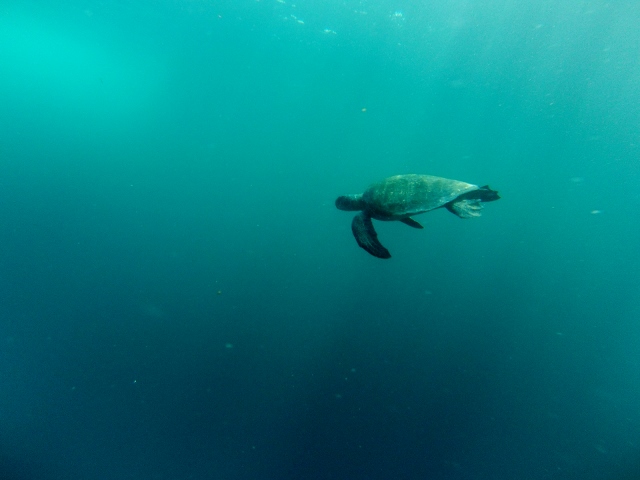
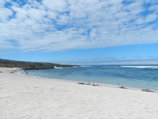
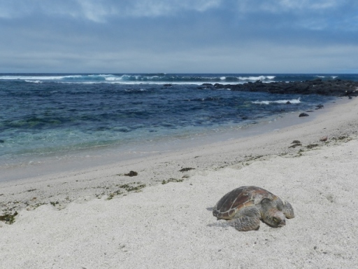
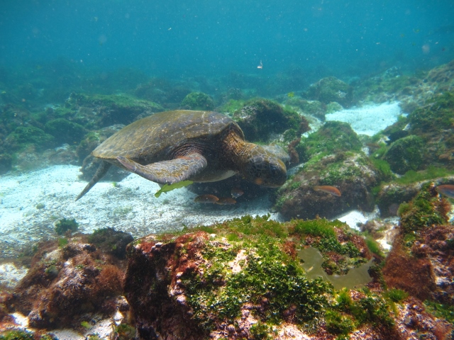
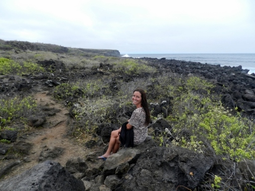
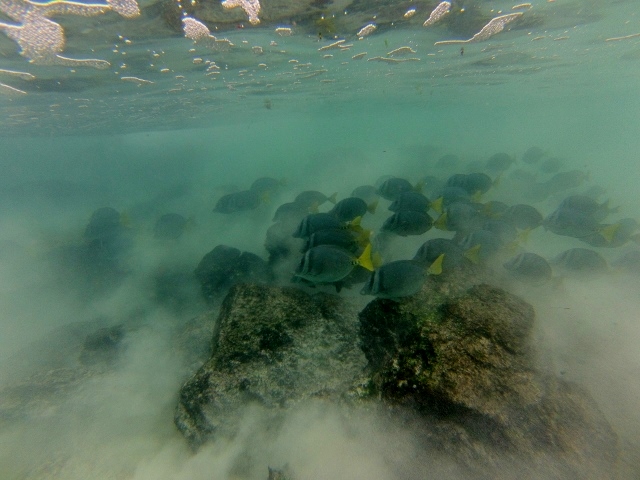
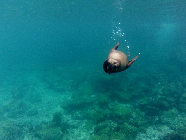
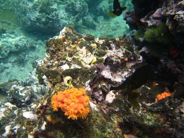
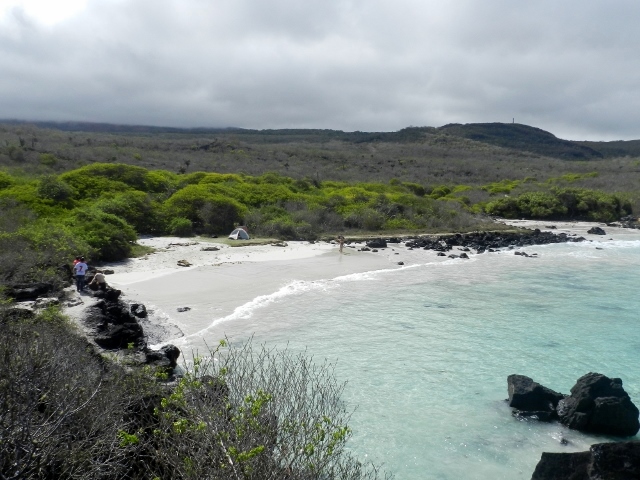
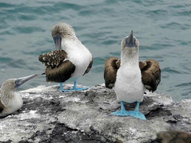
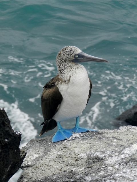
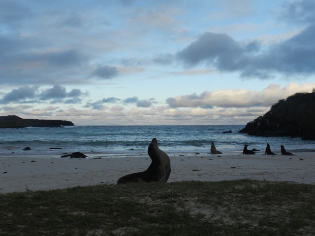
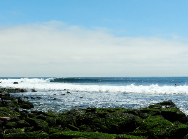
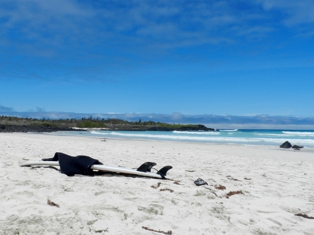
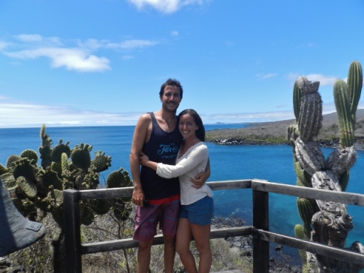
While doing some research in mainland Ecuador, we had read that it is possible to camp for free on some of the islands. Both agreeing that camping on the Galapagos Islands would be pretty epic, we decided to lug all of our backpacking gear with us and were determined to put it to use. While on San Cristobal Island, we discovered that in order to camp one has to request permission from the national park and all camping gear must be quarantined in a giant freezer for 48 hours to kill seeds and anything that might disturb or alter the natural environment. After dully going through this process we got clearance and a permission slip from the national park. We loaded our gear in the back of a cab, and headed to Puerto Chino, a beautiful white sand cove on the southern side of the island. We set up our tent on a little grassy knoll at the edge of the beach, right next to a group of sleeping sea lions. From there, we could see turtles swimming near the shore and blue footed boobies dive bombing into the sea in search of fish. It was a spectacular place to camp with no one on the beach but us and the sea lions- well worth the back strain.

DSCN9802 (640x480)

DSCN9661 (640x480)

This adorable baby sea lion hung out in front of our tent all afternoon

DSCN9599 (640x480)

Blue footed boobies

DSCN9623 (480x640)

DSCN9803

Although cute and graceful in the water, sea lions on land are pretty brutish. They are constantly sneezing, coughing, and barfing up fish, not to mention that they stink terribly. We thought they might deprive us of a peaceful night’s sleep, but each evening at sunset the sea lions woke up from their lazy day of sleeping and farting in the sand and headed into the ocean. We were surprised to notice that they would be out all night and watched them return one by one at sunrise. Very curious…

DSCN9830 (640x481)

Classic sea lion pose while his pals dash into the sea for the night

With a swell heading our way, we decided to push back our return flight another week so we could enjoy some more sun and waves and stay on the islands through Aron’s birthday. We posted up at Hotel San Francisco at a whopping $20/night for a clean, private room right on the boardwalk (who says you cant do the Galapagos on the cheap?) and made friends with the surfers in town. Along with two Brits, a Frenchman, and a couple of Ecuadorian locals who owned a bar in town, we trekked daily out to Tongo Reef, an awesome rocky left point break.

DSCN9997 (640x480)

DSCN0154 (640x480)

The boardwalk in Puerto Baquerizo Moreno on San Cristobal Island

DSCN9847 (640x481)

Marine Iguana in the path to Tongo

DSCN9877 (640x480)

A rocky entrance/exit at Tongo Reef

DSCN0176 (640x473)

DSCN9928 (640x479)

It was on one of these beach adventures that we ran into some graduate students from my alma mater, the Bren School of Environmental Science and Management at the University of California Santa Barbara. They were in the Galapagos doing research on the sustainable management of the local lobster fishery for their Master’s Thesis Project. It just so happened that we were on this same island, in the middle of the Pacific Ocean, surfing the same waves at the same time. To say small world would be putting it lightly. After being away for so long I was overjoyed to meet people from back home who were familiar with the world we left behind.

DSCN0007 (640x480)

Lounging in the sun with new friends

We spent day after day on the beach under a brilliantly blue sky with Aron surfing fun, peeling waves while I enjoyed the sun and watched turtles pop their heads up out of the crystal clear water. On our last day at Tongo Reef a whale played out on the horizon, breaching out of the water over and over while Aron and our British friend Liam traded waves in the foreground. It’s moments like these (and swimming with sharks) that I hope we remember for the rest of our lives.

DSCN0224 (640x480)

Even with the swell pulling back and the waves subsiding, I had to drag Aron away from San Cristobal Island. After a week and a half, we finally hopped on a ferry for the two hour ride to Santa Cruz Island where we had been invited to stay with our new Bren friends for our last four days in the Galapagos. Upon arriving at their house we found Norah in the kitchen, filleting a huge, fresh local tuna. She pleasantly informed us that we were going to be dining at their co-worker’s gorgeous family villa overlooking the bay. Oh la la! Thanks to Norah and Laura’s amazing cooking skills, we enjoyed a fabulous seared rare tuna dinner on the patio overlooking the glimmering lights of Puerto Ayora and the boats on the water. Definitely an unforgettable night with wonderful people and some of the best tuna we have had in our lives!

DSCN0238 (640x480)

Master chefs Norah and Laura whipping up an amazing dinner

DSCN0232 (640x480)

Lights of Puerto Ayora, the main town on Santa Cruz Island

While our hosts were busy at work Aron and I had the day to explore Santa Cruz Island. We rented bikes and took a cab up to the highlands in the center of the island for a little downhill tour. We rode alongside the road with rolling green hills and farms on both sides of us and were surprised to see herds of grazing cows. Definitely not how we imagined the Galapagos islands!

Our first stop was a ranch where giant tortoises roamed freely. We walked right up to them as they happily chowed down in grass in the middle of a field. Too occupied with eating, this guy barely even looked up as I inched in for a picture.

DSCN0283 (640x480)

And this guy just blended in perfectly.

DSCN0258 (640x480)

Although reluctant to leave the turtles behind, we had to keep moving in order to make it back to the coast before dark. As we rode along the red dirt roads reminiscent of Hawaii, we stopped to let a tortoise slowly cross the road in front of us. Along the way we spotted a number of other giant tortoises hanging out in the shrubbery. Funny to see these huge creatures roam freely in their natural habitat.

Our next stop was the lava tunnels, actual passageways that lava once flowed through when the volcano on the island was still active. Pretty wild to imagine hot magma once flowing where we were walking.

 DSCN0286 (640x480)

Laura and Aron happen to share the same birthday so on Saturday night we went out for a lobster dinner to celebrate. We splurged on langosta encocado- lobster in a creole coconut sauce- and washed it down with giant cold beers.

DSCN0304 (640x479)

After dinner we surprised the birthday kids with the most deliciously rich, decadent chocolate cake before heading out to the bars.

DSCN0322 (640x480)

The next morning after a big breakfast, we enjoyed our last day on the Galapagos Islands by hiking out to Tortuga Bay, a gorgeous powdery white sand beach with the most crystal clear turquoise water you can imagine. The sky was as blue as can be and we all played around in the little waves and enjoyed the deliciously cool water.

DSCN0352 (640x480)

DSCN0343 (640x480)

DSCN0387 (640x462)

Leaving the Galapagos Islands was harder than we could have ever imagined. When traveling, it’s not just the places that leave their impression on you, it’s the people you encounter and the experiences that you share that really make a place so amazing. We could not have had a better experience on the Galapagos Islands and hope to find our way back someday soon.

Categories: Ecuador | Tags: , , , , , | 5 Comments

Create a free website or blog at WordPress.com.